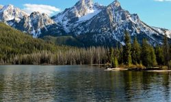
The days of relying solely on massive, unfolding paper maps are long gone. While having a physical map is still a smart backup for any serious backcountry trip, modern overlanding is powered by digital tools.
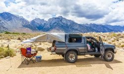
Whether you are trying to find a free dispersed campsite in a national forest, navigating a technical 4×4 trail without cell service, or simply looking for a place to take a shower after three days in the desert, your smartphone is your most valuable co-pilot.
However, the app store is flooded with clunky, outdated navigation tools. To save you time, we have tested and compiled the best overlanding apps that every truck camper needs in 2026.
Before you put your rig in drive, make sure these five essential apps are downloaded and your offline maps are saved.
1. iOverlander: The Holy Grail of Free Camping
If you only download one app from this list, make it iOverlander. It is a completely free, crowd-sourced database built by overlanders, for overlanders.
iOverlander doesn’t just show you official campgrounds. Its true power lies in its database of “Wild Camping” (dispersed) spots across the United States. You can find coordinates for hidden pull-offs on BLM (Bureau of Land Management) land, stealth camping locations in urban areas, and even places to fill up your water tanks or find a hot shower.
Because it is community-driven, you get recent reviews from other travelers. If a dirt road has washed out or a campsite is closed, you will usually find a warning from an overlander who was there just days ago.
Best For: Finding free, remote campsites and essential amenities on the road.
2. OnX Offroad: The Trail Master
When it comes to finding off-road trails and understanding land ownership boundaries, OnX Offroad is the undisputed champion.
The biggest fear for any overlander is accidentally trespassing on private property. OnX clearly highlights the boundaries between private land, National Forest, BLM land, and state parks. It features over 600,000 miles of motorized trails, color-coded by difficulty and vehicle type (e.g., full-size trucks vs. dirt bikes).
While OnX offers a premium subscription, the base features and the ability to download a certain amount of offline maps make it an absolute necessity for exploring the American West.
Best For: Knowing exactly whose land you are on and finding the best 4×4 trails.
3. Campendium: The Cell Service Savior
For the modern WildRigged adventurer, remote work is often part of the lifestyle. If you need to send an email or upload a video while living out of your truck bed, Campendium is your best friend.
Like iOverlander, Campendium lists thousands of RV parks, national parks, and free dispersed campsites. However, its standout feature is the crowd-sourced cell service reports. Users report the exact signal strength (e.g., “3 bars on Verizon, No service on AT&T”) for almost every location.
If you need to know whether you can take a Zoom call from a campsite deep in the woods, Campendium has the answer.
Best For: Digital nomads and finding campsites with reliable cell phone reception.
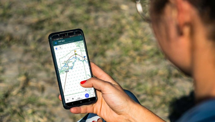
4. Gaia GPS: The Ultimate Route Planner
If you are the type of overlander who loves to meticulously plan routes before leaving home, Gaia GPS is the tool for you.
Gaia offers incredibly detailed topographic maps, satellite imagery, and weather overlays. It allows you to create custom waypoints, track your exact speed and elevation, and drop pins for future trips. Professional guides and search-and-rescue teams heavily rely on Gaia GPS for its precision.
It has a steeper learning curve than the other apps on this list, but once you master its interface, you will never get lost again.
Best For: Advanced route planning, topographic maps, and off-grid tracking.
5. GasBuddy: The Budget Defender
Overlanding in a fully loaded truck with heavy-duty tires and a roof rack means one thing: terrible gas mileage. When you are driving across the country, fuel is going to be your biggest expense.
GasBuddy is a simple but incredibly effective app that shows you the real-time prices of gas stations near your location. A difference of 30 cents per gallon might not seem like much in a compact car, but when you are filling a 30-gallon truck tank, those savings add up quickly.
Using GasBuddy to plan your fuel stops along major highways can literally save you hundreds of dollars over the course of a long road trip.
Best For: Saving money on fuel during long cross-country overlanding trips.
A Crucial Reminder: Always Download Offline Maps
All the apps in the world are useless if they require an internet connection in a place with zero bars.
The golden rule of overlanding is to download your maps while you are still sitting in your driveway connected to Wi-Fi. Apps like Google Maps, OnX, and Gaia all allow you to select large regions and save them directly to your phone’s hard drive.
Equip your smartphone with a sturdy dashboard mount, plug it into your portable power station, and let these digital tools guide you deeper into the wild.
Stay on the trail, and stay wild.